-
Oct 05, 2026
- by Ashley Chen
Bhutan Tests New Defences Against Thorthormi Glacial Flood Risk
Bhutan is testing siphon drainage and stronger warning systems at Thorthormi Lake as glacial flood risks threaten communities and hydropower.
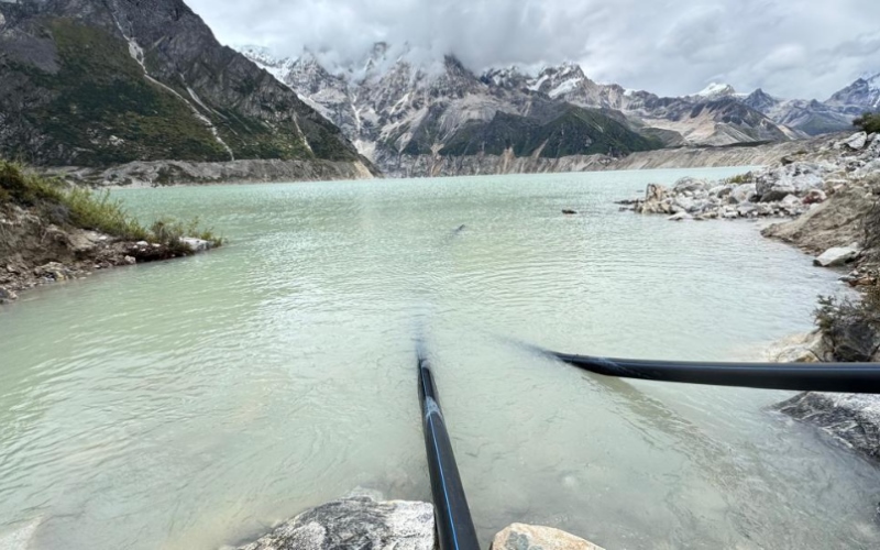
At more than 4,400 metres above sea level in northwestern Bhutan, glaciologist Karma Toeb and a team of specialists are testing a revised system to lower the water level of Thorthormi Lake.
The lake lies in Lunana, a remote high-altitude area of Gasa district. It is considered one of Bhutan’s potentially dangerous glacial lakes because of its expanding volume, unstable natural barriers and position above communities, farmland, historic sites and major hydropower infrastructure.
The team is testing siphon technology, which uses pipes and gravity to draw water from the lake in a controlled manner. The work is part of Bhutan’s wider effort to reduce the danger from glacial lake outburst floods, commonly known as GLOFs.
The risk extends far beyond Lunana. Water released from Thorthormi would enter the Pho Chhu and flow towards Punakha before continuing through a river basin containing some of Bhutan’s most important hydropower projects.
What Is a Glacial Lake Outburst Flood?
A glacial lake forms when meltwater collects beside or in front of a glacier. Many such lakes are held back by moraines, which are deposits of rock, soil and ice left behind by moving glaciers.
These natural barriers can weaken as a lake expands. A landslide, avalanche, earthquake or sudden movement of ice can send water over the barrier or cause it to fail.
The resulting flood can move rapidly through narrow mountain valleys. It may carry sediment, boulders, trees and other debris, increasing the damage to settlements and infrastructure downstream.
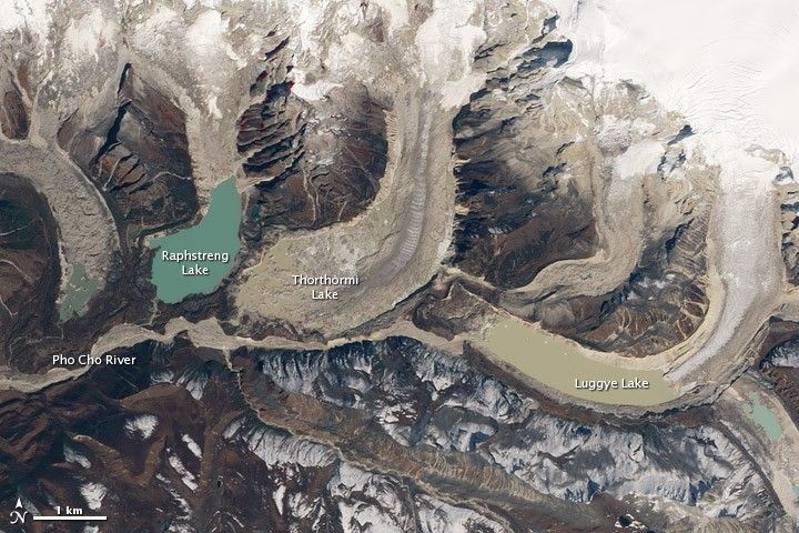
Bhutan experienced the consequences of such an event in October 1994, when an outburst from Luggye Lake killed 21 people and damaged homes, farmland and infrastructure along the Pho Chhu valley.
Thorthormi is part of the same high-altitude lake complex as Luggye and Raphstreng. Its location and changing physical condition have made it a focus of scientific monitoring and risk reduction work for more than two decades.
Bhutan Records More Glacial Lakes
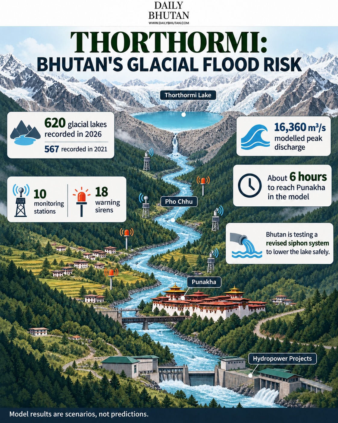
Bhutan’s 2026 national glacial lake inventory recorded 620 lakes, compared with 567 in 2021. Their combined area increased from approximately 55 square kilometres to more than 58 square kilometres.
The Pho Chhu sub-basin, which contains Thorthormi, Raphstreng and Luggye, recorded the largest rise. The number of lakes in the sub-basin increased from 157 to 187 over the five-year period.
The inventory used satellite images supported by automated mapping and expert review. The increase is consistent with the retreat of glaciers and the formation or expansion of meltwater lakes as temperatures rise.
The trend forms part of Bhutan’s wider water and glacier challenges, which affect water supplies, agriculture, settlements and energy infrastructure.
Not every glacial lake presents the same level of danger. Risk depends on factors including lake volume, the condition of its natural barrier, surrounding slopes and the number of people and structures in the potential flood path.
Flood Modelling Shows Risks Downstream
A peer-reviewed study published in 2024 modelled a possible failure at Thorthormi Lake.
Under its largest simulated breach, the flood reached a peak discharge of approximately 16,360 cubic metres per second about four hours after the breach began. The model estimated that as many as 1,277 buildings and 245 hectares of agricultural land could be exposed to inundation.
Punakha Dzong, a historic fortress and monastic complex approximately 90 kilometres downstream, could experience the flood peak about six hours after a breach. The dzong stands at the confluence of the Pho Chhu and Mo Chhu rivers and has previously been affected by flooding.
The six-hour estimate describes the simulated travel time of the flood peak. It should not be interpreted as a guaranteed six-hour evacuation window because detection, communication and local conditions would affect how much warning people actually receive.
The study also carried important limitations. Researchers did not have surveyed depth measurements for Thorthormi and therefore had to estimate the lake’s underwater shape. The model focused on water movement and did not fully represent the additional effects of debris.
It also did not simulate a cascading event in which water from Thorthormi might affect neighbouring Raphstreng Lake. Further field measurements and modelling would therefore be needed to define the full range of possible outcomes.
A Revised Siphon System Is Being Tested
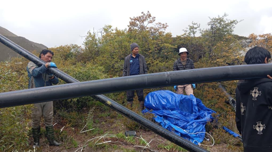
Bhutan has previously attempted to reduce the danger by manually lowering Thorthormi’s water level. Work conducted between 2008 and 2012 lowered the lake by approximately 3.7 metres and released an estimated 17 million cubic metres of water.
Working at this altitude is difficult. Equipment and supplies must be transported across mountainous terrain, while cold temperatures, unstable ground and a short working season limit construction.
A siphon test conducted in 2025 did not establish a continuous flow. Although water began moving through the pipe, the available difference in elevation was not sufficient to overcome the height of the system and resistance inside it.
The team returned in 2026 to test a revised arrangement near the lake’s existing outlet. The location and engineering configuration were adjusted in response to problems identified during the earlier attempt.
If successful, siphoning could offer another way to lower the lake without cutting a large drainage channel through unstable terrain. It would remain one part of a broader risk management system rather than a complete solution.
Monitoring Stations Provide Real-Time Alerts
Bhutan has installed 10 upstream water-level and weather monitoring stations and 18 warning sirens across the Punatsangchhu basin. Monitoring sites include high-altitude lakes in Lunana, approximately 130 kilometres upstream of the Punatsangchhu hydropower projects.
Information is transmitted to a control room operated by the National Center for Hydrology and Meteorology. Stations around the glacial lakes can send updated observations at 15-minute intervals.
The present system is mainly designed to detect a flood as it begins. Bhutan has also been working towards forecast-based warnings that would use rainfall, temperature and other indicators to identify dangerous conditions before an outburst or related flood develops.
Forecasting is more complex because a GLOF can result from several interacting processes. These include glacier retreat, lake expansion, avalanches, slope failures and intense rainfall.
Evacuation planning remains essential. Authorities in Punakha have conducted drills to identify escape routes, organise response teams and improve public understanding of the warning system.
Hydropower Raises the Economic Stakes
The flood path from Thorthormi runs towards two of Bhutan’s largest energy projects.
The 1,020-megawatt Punatsangchhu-II project began partial generation in December 2024 and was formally inaugurated in November 2025. The 1,200-megawatt Punatsangchhu-I project remains under construction.
A severe flood could affect energy facilities even when dams and spillways are designed to handle large volumes of water. Sediment, trees and boulders can obstruct intakes, tunnels and gates. Floods can also damage access roads, transmission lines and construction sites.
Hydropower normally contributes approximately 12 to 15 percent of Bhutan’s gross domestic product. Electricity exports to India reached Nu 24.71 billion (approx. USD 257 million) in 2025.
India provides Bhutan with a large market for electricity that cannot be consumed domestically. It has also financed and supported the construction of several Bhutanese hydropower projects. This makes climate resilience important to both Bhutan’s economy and its long-standing energy relationship with India.
Regional events have shown how mountain hazards can affect entire electricity systems. The destructive floods along the Nepal-China border in August 2026 damaged multiple hydropower facilities and disrupted electricity production and transmission.
That disaster resulted from a high-altitude rock and ice collapse rather than a confirmed GLOF. It nevertheless demonstrated how avalanches, landslides, floods and heavy debris can combine into a much larger emergency.
Energy Expansion Will Require Climate-Resilient Planning
Bhutan’s National Energy Policy 2025 targets 25,000 megawatts of installed power capacity by 2040. This includes 20,000 megawatts of hydropower and 5,000 megawatts of solar energy.
Reaching that target would require major investment in generation, transmission and energy storage. It would also increase the importance of evaluating climate and geological risks before projects are approved.
Bhutan’s public and publicly guaranteed debt stood at approximately 118 percent of gross domestic product at the end of the 2024 to 2025 financial year. Hydropower loans represented about 55 percent of the country’s external debt.
The financing structure of projects developed with India reduces some immediate repayment risks. However, prolonged disruption to electricity generation could still reduce export earnings, government revenue and the funds available for other public priorities.
Thorthormi therefore presents more than a local environmental concern. It connects climate change in Bhutan’s high mountains with public safety, cultural heritage, national finances and regional electricity trade.
The revised siphon test may help lower the lake, but managing the wider risk will require continuous monitoring, reliable warnings, evacuation planning and stronger climate assessments for infrastructure throughout the river basin.